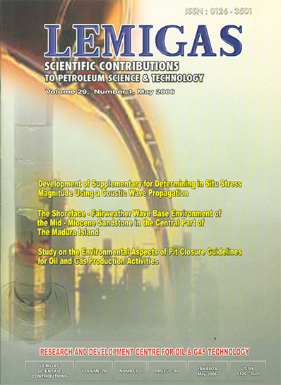
THE SHOREFACE - FAIRWEATHER WAVE BASE ENVIRONMENT OF THE MIDMIOCENE SANDSTONE IN THE CENTRAL PART OF THE MADURA ISLAND
DOI:
https://doi.org/10.29017/SCOG.29.1.1021Keywords:
Environment, Mid-Miocene, SandstoneAbstract
As mentioned in the previous paper (Endharto, 2005) this paper is part of the series of the depositional model of the Ngrayong Sandstone, which takes part especially in the central part of the Madura Island. This study also examines physical evidence of the best exposure of the study area. The central part is located between 07 01' 18" S - 113 32' 56" E and 07 04' 55" S- 113 36' 54" E, covering the area of Tanjung - Pasean to the north and Mentok - Kertengeneh - Sentol to the south. (Figure 1). The Geological work was carried out during June - July 2005, where the particular attention was concentrated within the central region of the island. There are 3 major key outcrop areas were studied and assigned for the depositional setting of this area (i.e., Tanjung toward Pasean River, Mentok - Kertengeneh Oil Field and Sentol Daya sections). This worked has attempted to sort it out both vertical and horizontal sections with applying the stratigraphic measuring sections (outcrop/surface logs), horizontal distance using passing compass, supported by petrography and paleontology analysis, and trying to look at the internal sedimentological structures to get into broadly image of the depositional system within this area.References
Ardhana, W., Lunt, P., & Burgon, G. E., 1993. The deep marine sand facies of the
Ngrayong Formation in the Tuban Block, East Java Basin. Indonesian Petroleum
Association Clastic Core Work- shop, October 1993. p. 117-175.
Azis, S., Sutrisno, Noya, Y & Brata, K., 1993. Geology of Tanjungbumi and Pamekasan,
Jawa (Madura Island). Geological Map; Quadrangle 1609-2 & 1608-5, scale 1:100,000.
Geological Research and Development Centre.
Bemmelen, R. W., van, 1949. The Geology of Indonesia Vol. IA. Martinus Nijhoff. The
Hague. 732p.
Brouwer, H. A., 1917. Geologishce Overzichakaart van Den Nederlandsch-Oost Idishen
Archipel Batavia, Landsdruk kerij. Unpublished.
Collinson, J. D. & Thomson, D. B., 1989. Sedimentary structure. Unwin Hyman, London,
nd edition, 207p.
Duyfjes, J., 1938. Toeclichting bij blad 115 (Soerabaja), schaal 1:100,000. Geologisch
Kaart van Java. Unpublished.
Endharto, M., 2005. The tidal flat shelf depositonal system of the Ngrayong Sandstone in
the western part of the Madura Island, East Java, Madura Island. Journal of Geological
Resources, Vol. XV, No.2-July, p. 61 - 80.
Hartono, H. M. S., 1973. Geological map of Tuban sheet, East Java. Geological Survey,
Bandung.
Johnson, H. D. & Baldwin, C. T., 1996. Shallow clastic seas. In:Sedimentary Environment:
Processes, Facies and Stratigraphy. H. G Reading (editor) 3rd Edition, Blackwell Science.
p. 232- 280.
Kemp, G. 1998. Sampang PSC, East Java, Indonesia, 1998. Geological field survey
recommendation. Report# SEABU052.
Koesoemadinata, R. P., 1969. Tertiary Stratigraphy of East Java Basinal Area. Cities
Service Oil Company. Unpublished.
Latief, R., May, P. & Suseno, A. 1990. Indonesian Petroleum Association Post Convention
Field Trip 1990 Madura Island, October 19-21, 1990. Guide Book, 79p.
Mulhadiono, 1984. Tinjauan Stratigraphy dan Tataan Tektonik di Pulau Madura, Jawa
Timur. PITIAGI ke XII Bandung.
Pemberton, S. G, MacEachern, J. A. & Frey, R. W., 1992. Traces fossil facies models:
Environmental and allostratigraphic significant. In: Facies Model; Response to Sea Level
Change. R. G. Walker & N. P. James (eds), p.47-72.
Pringgoprawiro, H., 1980. Stratigrafi Cekungan Jawa Timur Utara, Laporan penelitian No.
, ITB Bandung. Unpublished.
Raaf, J. F. M., de Boersma, J. R. & Gelder, A. V., 1977. Wave generated structures and
sequences from shallow marine succession, Lower Carbonaceous, County Cork, Ireland,
Sedimentology, 24, p.451-483.
Situmorang, R. L., Agustianto, D. A., & Suparman, S., 1992. Geology of the WaruSumenep, Jawa (Madura Island). Geological Map; Quadrangle 1609-3, 1608-6, 1709-1 &
-4, scale 1:100,000. Geological Research and Development Centre, Bandung.
Sukardi, 1992. Geology of the Surabaya & Sapulu, Jawa (Madura Island). Geological Map;
Quadrangle 1608-4 & 1609-1. Geological Research and Development Centre, Bandung.
Wilson, M. E. J., 1995. The Tertiary evolution of South Sulawesi: a record in redeposited,
carbon- ate of the Tonasa Limestone Formation; In: Hall, R. & Blundell, D. J., (eds);
Tectonic Evolution of Southeast Asia. The Geological Society of London, Special
Publication, No. 106, p. 365-389
Downloads
Issue
Section
License
Copyright (c) 1970 SCIENTIFIC CONTRIBUTIONS OIL AND GAS (SCOG)

This work is licensed under a Creative Commons Attribution 4.0 International License.
Authors are free to Share — copy and redistribute the material in any medium or format for any purpose, even commercially Adapt — remix, transform, and build upon the material for any purpose, even commercially.
The licensor cannot revoke these freedoms as long as you follow the license terms, under the following terms Attribution — You must give appropriate credit , provide a link to the license, and indicate if changes were made . You may do so in any reasonable manner, but not in any way that suggests the licensor endorses you or your use.
No additional restrictions — You may not apply legal terms or technological measures that legally restrict others from doing anything the license permits.


